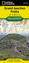
National GeographicTrails IllustratedColorado Grand Junction / FruitaTopo Map 502.
More than just a map, National Geographic Trails Illustrated topographic maps are designed to take you into the wilderness and back. Printed on tear-resistant, waterproof material, this map can go anywhere you do. Each map is based on exact reproductions of USGS topographic map information, updated, customized, and enhanced to meet the unique features of each area. The maps include valuable wilderness tips and Leave No Trace guidelines, along with updated trails, trailheads, points of interest, campgrounds, and much more. With a new color palette and stunning shaded relief, backcountry navigation has never been easier.
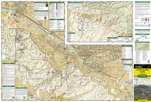
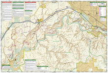
TheGrand Junction / FruitaTrails Illustrated map is the most comprehensive recreational map for this beautiful area of Colorado.Jam packed with over 500 miles of single-track and multi-use trails, our new National Geographic Trails Illustrated map for the mountain biking mecca of Grand Junction & Fruita, Colorado is ideal for anyone hitting the trails.
Like all Trails Illustrated maps, Grand Junction / Fruita blends detailed topography with carefully researched trail information. Rated mountain biking trails with mileages, recommended rides, and difficulty rating charts make this an ideal planning tool for novice and expert alike. An enhanced scale of 1:35,000 (1 = 0.55 Miles) makes it easy to read elevations and identify the numerous trails throughout the area.
Grand Junction / Fruita Trails Illustrated is printed on environmentally friendly waterproof/tear-resistant material with low VOC inks at our green-certified printer in Ft. Collins, CO.
National Geographic Trails Illustrated maps are developed in conjunction with local land managers and regional experts throughout all phases of the production process. This hands-on approach ensures that our maps have the most accurate and detailed information available.
Coverage includesWestwater Mesa & Rabbit Valley,Mack Ridge and Kokopelli Loops,Lunch Loops and Bangs Canyon,North Fruita & 18 Road,McInnis Canyons National Conservation Area,Black Ridge Wilderness,Westwater Canyon,Colorado National Monument,Colorado Riverway,Kokopelli and Tabugache Trails,The towns of Grand Junction and Fruita.
Features:
- Approximately 4.25" x 9.25" folded; 26" x 38" fully opened
- Scale =1:35,000
- Waterproof, tear-resistant
TIP:For lower prices on our maps, check out our promotions (click the link above the picture). Here is the info: Purchase 2 - 3 maps and get 10% off, 4 or more willget you 15% off! This promo includes ALL of our maps. For example, purchase 2 Trails Illustrated maps, 1 Destination map, and 1 Adventure map (total of 4) and get15% off!! Just put everything in your shopping cart and you will see the savings!
Requirements: None.
You will receive: 1National GeographicTrails Illustrated Map.
Retailpackaging, shipped in a poly envelope. Shipping weight 4 oz.
If you have any questions or concerns, please contact us before or after the sale - we want you to be a happy customer!
Thanks for looking!


