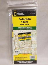
BRAND NEW National Geographic Trails Illustrated Colorado 14ers Topographic Map Guide Bundle Pack.
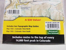
• Waterproof • Tear-Resistant • Topographic Map Guide
Colorado has the highest mean elevation of any state in the United States. It's home to 58 mountain peaks higher than 14,000 feet—more than any other state in the U.S—making it a mountain sports mecca. "Bagging" these fourteeners is a goal for many Coloradans and visitors to the state—and for some, it's an obsession.
Each map page provides accurate trail statistics including trail mileages, total elevation gain and loss, trailhead elevations and elevations at trail junctions, and directions to trailheads. Route information includes climbing class (i.e. difficulty rating) and points of reference along the route. The maps include both 2WD and 4WD trailhead locations for the standard, recommended route.
The Map Pack includes every 14,000 peak in Colorado in a single, easy to purchase bundle.
The Colorado 14ers Map Pack includes:
Map 1302 :: Colorado 14ers North
Map 1303 :: Colorado 14ers South
Colorado 14ers North - The Colorado 14ers North Topographic Map Guide provides the most accurate and convenient set of maps for the fourteeners of the Front, Mosquito, Tenmile, and Sawatch ranges of northern Colorado. Almost half of Colorado's fourteeners fall in these ranges, but their proximity to large population centers leave no shortage of hikers on their slopes. Moderate ridges, established trails, and accessible trailheads are the norm on the standard routes, making many of these peaks relatively easy to climb. However, it's important to note that these seemingly gentle giants also have their rugged side—including the north face of Mount Evans, the amphitheater north of Mount Democrat, Ellingwood Ridge on La Plata Peak, and the sheer east face of Longs Peak—placing them among the most challenging alpine experiences in the United States.
Peaks found in this map guide include:
Front Range: Mount Bierstadt, Mount Evans, Grays Peak, Longs Peak, Pikes Peak, Torreys Peak
Mosquito, Tenmile Ranges: Mount Bross, Mount Cameron*, Mount Democrat, Mount Lincoln, Quandary Peak, Mount Sherman
Sawatch Range: Mount Antero, Mount Belford, Mount Columbia, Mount Elbert, Mount Harvard, Mt of the Holy Cross, Huron Peak, La Plata Peak, Mount Massive, Missouri Mountain, Mount Oxford, Mount Princeton, Mount Shavano, Tabeguache Peak, Mount Yale
* Unofficial 14er - Summit above 14,000 feet, but considered unofficial because the peak does not rise 300 feet above the saddle that connects to a higher peak.
Colorado 14ers South - The Colorado 14ers South Topographic Map Guide provides the most accurate and convenient set of maps for the fourteeners of the Elk, San Juan, and Sangre de Cristo ranges of southern Colorado. These peaks are generally more difficult than their northern counterparts in the Front, Mosquito, Tenmile, and Sawatch Ranges. Even the easier exceptions, such as Humboldt, Sunshine, Redcloud, and Handies Peaks have their unforgiving slopes. Crestone Peak and Little Bear in the Sangre de Cristos, along with Capitol Peak and the Maroon Bells in the Elk Range, are often in the running when talk turns to the "hardest" fourteener. Given such subjective elements as physical conditioning, skill of party members, weather and season, there is no definitive answer, but all deserve the utmost respect and attention to route finding.
Peaks found in this map guide include:
Elk Range: Capitol Peak, Castle Peak, Conundrum Peak*, Maroon Peak, North Maroon Peak*, Pyramid Peak, Snowmass Mountain
San Juan Range: El Diente Peak* , Mount Eolus, North Eolus*, Handies Peak, Redcloud Peak, San Luis Peak, Mount Sneffels, Sunlight Peak, Sunshine Peak, Uncompahgre Peak, Wetterhorn Peak, Mount Wilson, Wilson Peak, Windom Peak
Sangre De Cristo Range: Blanca Peak, Challenger Point, Crestone Needle, Crestone Peak, Culebra Peak, Ellingwood Point, Humboldt Peak, Kit Carson Peak, Mount Lindsey, Little Bear Peak
* Unofficial 14er - Summit above 14,000 feet, but considered unofficial because the peak does not rise 300 feet above the saddle that connects to a higher peak.
Each map page provides accurate trail statistics including trail mileages, total elevation gain and loss, trailhead elevations and elevations at trail junctions, and directions to trailheads. Route information includes climbing class (i.e. difficulty rating) and points of reference along the route. The maps include both 2WD and 4WD trailhead locations for the standard, recommended route. The standard route is the most sustainable route recommended by land managers in effort to preserve the fragile alpine environment of these peaks.
More convenient and easier to use than folded maps, but just as compact and lightweight, National Geographic's Fishing & River Map Guide booklets are printed on "Backcountry Tough" waterproof, tear-resistant paper with stainless steel staples. A full UTM grid is printed on the map to aid with GPS navigation.
Features:
- Accurate topography/terrain with clearly labeled details
- Full UTM grid for GPS use
- Each page provides statistics like mileages, elevations, & trailheads
- Climbing route difficulty ratings
- 2WD & 4WD trailhead locations
- Detailed topographic maps
- Booklet format - more convenient and easier to use than folded maps
- Waterproof and tear-resistant paper with stainless steel staples
- Scale: 1:63,360
- Size: 4.25" x 9.38"
- Weight: Approx. 3.2 oz each
TIP: For lower prices on our maps, check out our promotions (click the link above the picture). Here is the info: Purchase 2 - 3 maps and get 10% off, 4 or more will get you 15% off! This promo includes ALL of our maps. For example, purchase 2 Trails Illustrated maps, 1 Destination map, and 1 Adventure map (total of 4) and get 15% off!! Just put everything in your shopping cart and you will see the savings!
Requirements: None.
You will receive: 1 National Geographic Topographic Map Guide Bundle Pack.
Retail packaging, shipped in a poly envelope. Shipping weight 8 oz.
If you have any questions or concerns, please contact us before or after the sale - we want you to be a happy customer!
Thanks for looking!


