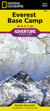
National Geographic Adventure Map Everest Base Camp AD00003001
• Waterproof • Tear-Resistant • Travel Map
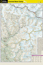
Outdoor adventurers trekking in the Himalayas will find National Geographic's Everest Base Camp Adventure Map an essential tool while preparing for their ascent up the world's highest mountain. This expertly researched map covers with unparalleled detail the area from the town of Lukla, through Sagarmatha National Park to Mt. Everest's South Base Camp located in Nepal, including major and minor trek routes, topographical information and points of interest. The neighboring Makalu Barun National Park is covered along with sections of the Mahalangur, Hinku and Kyashar Himals and the China-Nepal Border.
An index of places, passes, lakes and peaks, including Mt. Everest, will help you find both destinations and obstacles along on your adventure. Topographic information such as contour lines, elevations, mapped peaks and passes, water features, glaciers and forested areas will aid in your navigation. Other pinpointed features include with airports, campsites, lodging facilities, temples, monasteries, chortens, caves, waterfalls, hot springs and settlements. A multi-lingual legend (in English, German, French and Italian) will assist in your communication with international explorers.
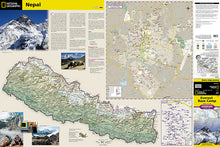
The reverse side displays a map of Nepal in its entirety along with inset maps the Kathmandu region and of the Thamel neighborhood. These inset maps show roads, hotels, embassies and consulates, police stations, banks, shopping complexes, hospitals and places of worship. Included also is background information about visiting and trekking in Nepal.
Every Adventure Map is printed on durable synthetic paper, making them waterproof, tear-resistant and tough — capable of withstanding the rigors of international travel. Each is two-sided and can be folded to a packable size of (4.25" x 9.25"); unfolded size is (26" x 38").
Features:
- Waterproof and tear-resistant
- Accurate topography/terrain with a clearly labeled road network
- Hundreds of points of interest, including the locations parks and nature reserves, protected lands, historical and cultural attractions
- Thousands of place names including towns and natural features; detailed place names index
- Important travel networks including airports, lighthouses, ferry routes and rail lines
- Updated regularly to ensure accuracy
TIP: For lower prices on our maps, check out our promotions (click the link above the picture). Here is the info: Purchase 2 - 3 maps and get 10% off, 4 or more will get you 15% off! This promo includes ALL of our maps. For example, purchase 2 Trails Illustrated maps, 1 Destination map, and 1 Adventure map (total of 4) and get 15% off!! Just put everything in your shopping cart and you will see the savings!
Retail packaging, shipped in a poly envelope. Shipping weight 4 oz.
If you have any questions or concerns, please contact us before or after the sale - we want you to be a happy customer!
Thanks for looking!


